We use cookies on our website.
Some of them are necessary for the functioning of the site, but you can decide about others.
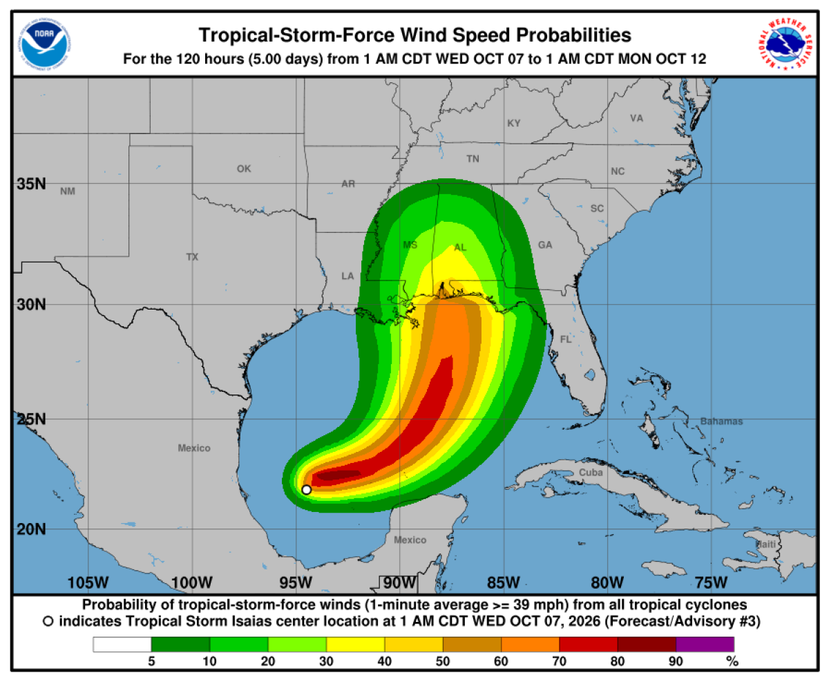
Tropical Storm Isaias formed in the Gulf of Mexico early Wednesday, October 7, and is forecast to strengthen rapidly into a hurricane by Thursday, according to NOAA’s National Hurricane Center.
At 4 a.m. CDT Wednesday, the storm had maximum sustained winds of 40 mph and was moving east-northeast at 8 mph. Its centre was approximately 285 miles west of Progreso, Mexico, and 580 miles southwest of the mouth of the Mississippi River.
The National Hurricane Center’s forecast calls for the system to pass north of the Yucatán Peninsula on Thursday before approaching the northern U.S. Gulf Coast on Friday.
Southeastern Louisiana to Florida Panhandle
Heavy rainfall could affect the region from Friday through the weekend. NOAA’s October 6 advisory forecast totals of 3–6 inches, with local amounts up to 10 inches, bringing the possibility of flash flooding, urban flooding and isolated river flooding.
Mexico’s Yucatán Peninsula
Gusty winds are possible in parts of the peninsula on Thursday. Swells are expected to affect western and northern coastal areas from the same day, potentially producing life-threatening surf and rip currents.
Coastal areas around the Bay of Campeche could receive 2–4 inches of rain through Thursday, with isolated higher amounts in Campeche and western Yucatán.
The National Hurricane Center has urged people in the Yucatán Peninsula and along the northern U.S. Gulf Coast to closely monitor the system’s progress.
Don't miss a single travel story: subscribe to PAX today! Click here to follow PAX on Facebook.